
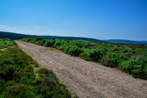
Monkham Hill [Withycombe Common]
Good walks are even better shared.
Overview
Monkham Hill [Withycombe Common]
Nestled within the picturesque Devonshire countryside, Monkham Hill stands proudly at 156 meters tall. Don’t let the modest elevation fool you; this Marilyn features stunning surrounding landscapes and a wealth of walking opportunities.
Geology
The geological makeup of Monkham Hill showcases a delightful blend of clay and chalk, which tells tales of ancient seas and soft sedimentary deposits. As you traverse the pathways, keep an eye out for unusual rock formations that dot the hillside—perfect for a quick geology lesson to impress your friends!
Access
Getting to Monkham Hill is a breeze. The nearest parking is conveniently situated along Withycombe Common, and it won’t cost you a penny. If you prefer public transport, a limited bus service from the bustling town of Exmouth can drop you off nearby, though it's a bit of a trek to the footpath. Exmouth itself is packed with amenities, perfect for coffee or a cheeky slice of cake post-hike.
Routes
One of the most popular ways to ascend the hill is via the Withycombe Common Path. This moderately challenging circular route comes in at approximately 4.5 km, offering a great balance of scenic beauty and gentle exercise. Make sure to wear sturdy shoes—those rabbit holes can be quite mischievous!
Summit Features
At the top, you’ll find a small grassy knoll, an inviting spot to rest your legs. It may not come with a fancy café, but the panoramic views of the Exe Estuary and East Devon hills are nothing short of sublime.
Views
When the sun shines, which it does quite a bit in this part, the views from the summit are breathtaking. The stretch of the Jurassic Coast appears like a postcard—a perfect backdrop to your epic Instagram shots. Spring and early autumn are the best times for those views, when the countryside is alive with colour and the air is just right.
Hazards
While Monkham Hill is generally an accessible hike, be wary of slippery conditions after rain, and keep an eye on your footing to avoid becoming intimate with any bunny burrows along the way!
Nearby Summits
Don’t stop your adventure here—Woodbury Hill and Aylesbeare Common are both within reach and offer their own unique charms.
Conclusion
In essence, Monkham Hill is the perfect blend of tranquillity, nature, and accessible adventure. Whether you’re a seasoned hiker or simply looking for a relaxing day out in the fresh air, this delightful hill is worth a visit!
Remember, every hike is an adventure, so lace up those boots and get exploring!
Explore routes near Monkham Hill [Withycombe Common]
Public walks starting within 80 km of this hill. Nearby does not mean a route reaches the summit; check its map and access before setting out.
Dunster, Gallox Bridge and Bats Castle: deer park hillfort circuit
View route
Ramscombe, Dead Woman’s Ditch and Adscombe woodland circuit, Quantock Hills
View route
Doone Valley circular walk from Malmsmead
View route
Sampford Peverell to Whipcott Bridge: Grand Western Canal return
View route
Route planning notes
These notes describe possible approaches, not verified navigable routes or permission to cross land. Check current paths, local access rules and conditions before setting out.
Withycombe Common Path
A delightful circular walk starting from Withycombe Common, weaving through lush countryside and offering perfect views of the surrounding hills.
Make a day of it, together
Find someone to share the walk with, or organise a day out along a route you like.
Photo Gallery
View all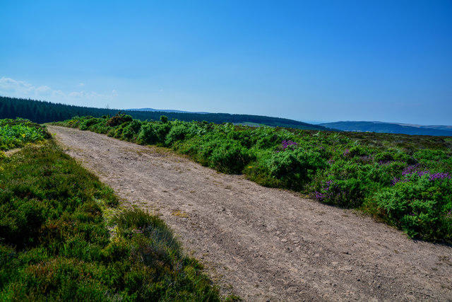 Photo could not load
SS9839 : West Somerset : Withycombe Common Footpath
Lewis Clarke
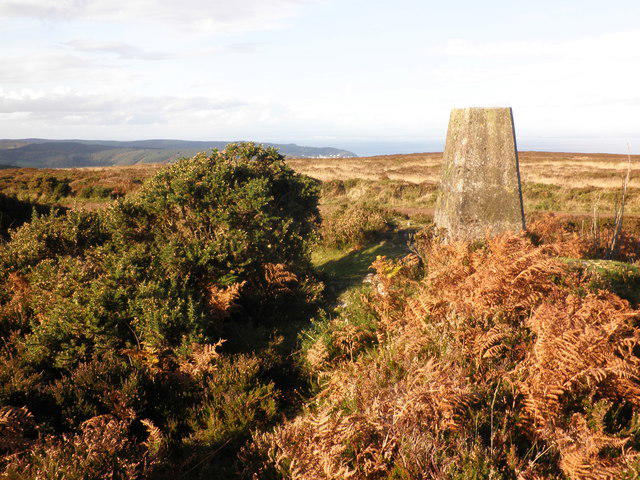 Photo could not load
SS9839 : Trig Point, Withycombe Common
Roger Cornfoot
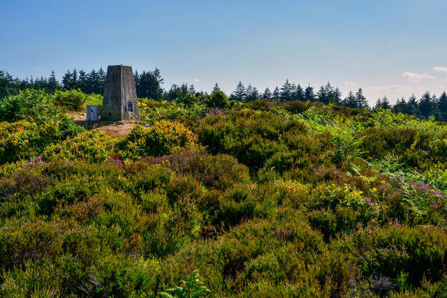 Photo could not load
SS9839 : West Somerset : Withycombe Common - Trig Point
Lewis Clarke
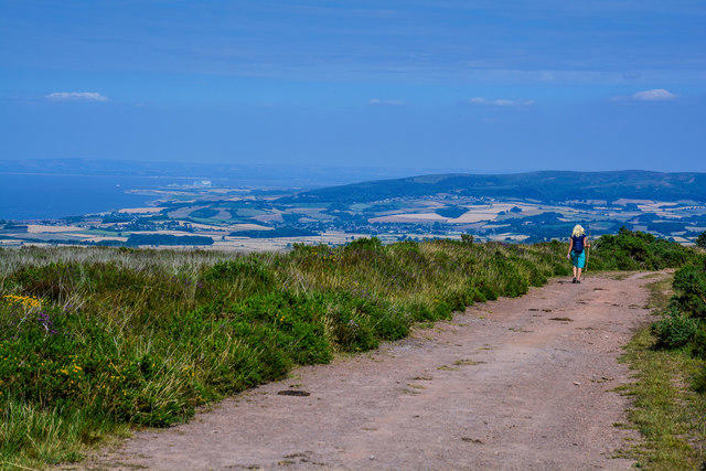 Photo could not load
SS9839 : West Somerset : Withycombe Common Footpath
Lewis Clarke
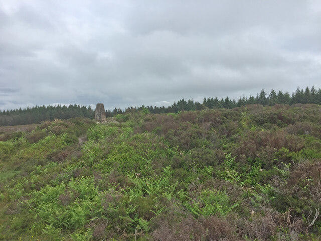 Photo could not load
SS9839 : Croydon Hill Trig Point Flush Bracket S3759
thejackrustles
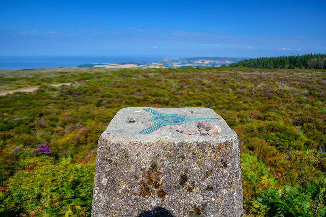 Photo could not load
SS9839 : West Somerset : Withycombe Common - Trig Point
Lewis Clarke
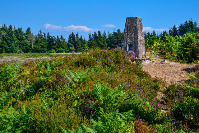 Photo could not load
SS9839 : West Somerset : Withycombe Common - Trig Point
Lewis Clarke
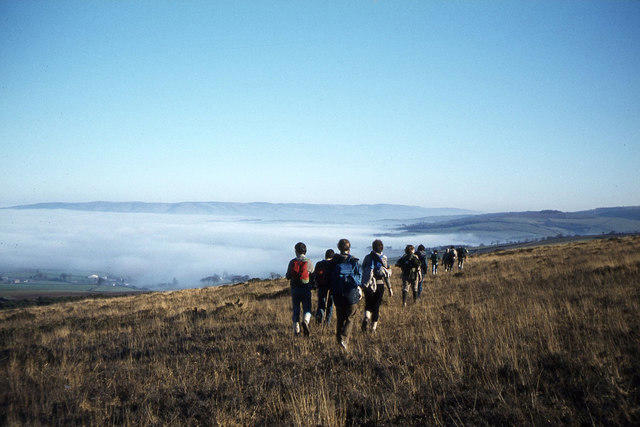 Photo could not load
SS9839 : Walkers descending east from Croydon Hill
Colin Park
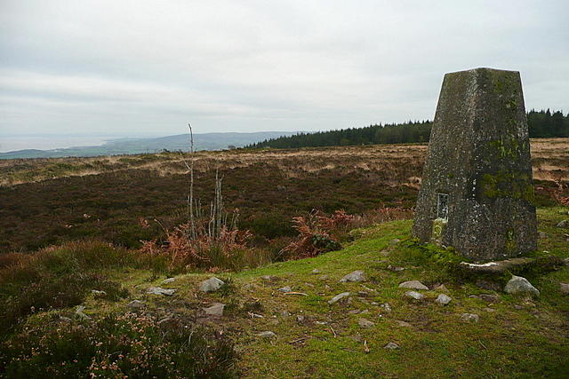 Photo could not load
SS9839 : Trig point on Withycombe Common
Graham Horn
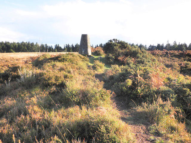
SS9839 : Summit of Withycombe Common
Roger Cornfoot
Hill facts and local notes
Classifications
Elevation
382m
1,252 ft
Prominence
123m
Coordinates
51.1444, -3.4493
SS987393
OS Map
181
Explorer: OL9E
At the Summit
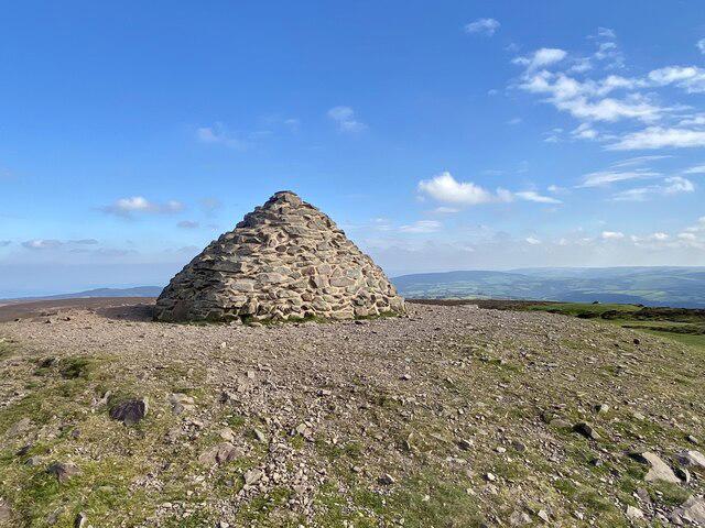
The summit is marked by a small grassy knoll, accompanied by a few scattered rocks which provide an ideal resting spot to enjoy the views.
Terrain & Geology
Monkham Hill features a mix of clay and chalk, providing interesting geological formations that speak to the region's varied past. The hill is primarily composed of sedimentary rock, shaped over millennia by both natural erosion and human activity.
Views & Scenery
On a clear day, you can see the shimmering Exe Estuary and the rolling hills of East Devon. The iconic Jurassic Coast can also be a stunning sight in the distance.
History & Heritage
Name Origin
The name 'Monkham' is thought to derive from 'Monk's home', likely linked to the area's monastic history.
Historical Significance
Monkham Hill has been a quiet retreat for centuries, and while it may not have the grandeur of some peaks, it offers a peaceful escape to nature.
Getting There & Facilities
Check current local access restrictions, parking rules and transport timetables before travelling. These notes do not confirm public access to the summit.
Parking
Free parking available on Withycombe Common's roadside near the entrance to the footpath.
Public Transport
Limited bus services operate from Exmouth to nearby villages, with the nearest stop approximately 1 km away.
Nearby Facilities
The nearest facilities, including cafés and toilets, are located in Exmouth, which is a short drive from the hill.
Safety Information
Known Hazards
- Mild slopes can become slippery after rain. Bunny burrows may surprise the unwary walker.
General Safety Tips
- Check weather conditions before setting out
- Carry appropriate clothing and equipment
- Let someone know your planned route
- Take a map, compass, and GPS device
- Carry emergency supplies: food, water, first aid kit, torch
Hills
Some common questions about the hills answered
Are there group walks up Monkham Hill [Withycombe Common]?
Many walkers use Walkmates to join or organise walks with others. You can check for group walks around Monkham Hill [Withycombe Common] through the maps
Are there other walkers around Monkham Hill [Withycombe Common]?
Activity varies by location and time, but Walkmates lets you see whether others have shared walks or shown interest in this area. Find other people through the walking friends search walking friends for Monkham Hill [Withycombe Common] search or of course create your own walk for Monkham Hill [Withycombe Common]
Can I organise a walk to Monkham Hill [Withycombe Common]?
Yes. If there aren’t any walks listed already, you can create a walk and make it available for others to join.
If you're signed up to Walkmates, you can create a walk to Monkham Hill [Withycombe Common].
How do I find a walk up this hill?
There are often multiple ways to walk this hill, depending on experience and route preference. Walkmates helps you explore walks and routes that others have shared.
Can I suggest a new route up Monkham Hill [Withycombe Common]?
Yes. You can suggest or create routes to share with others. Walkmates focuses on the social side of walking, so routes are used to help people organise walks and explore areas together, rather than as detailed navigation tools or route libraries.
Other uses really appreciate knowledgeable walkers sharing their routes. Share your favourite route to Monkham Hill [Withycombe Common] here
The is an error or something incorrect about this hill. How do I let you know?
We always strive to keep the information on Walkmates as accurate as possible. If you find an error, please let us know through the contact form and we'll aim to correct it as quickly as possible
Community Discussion
Comments
Location
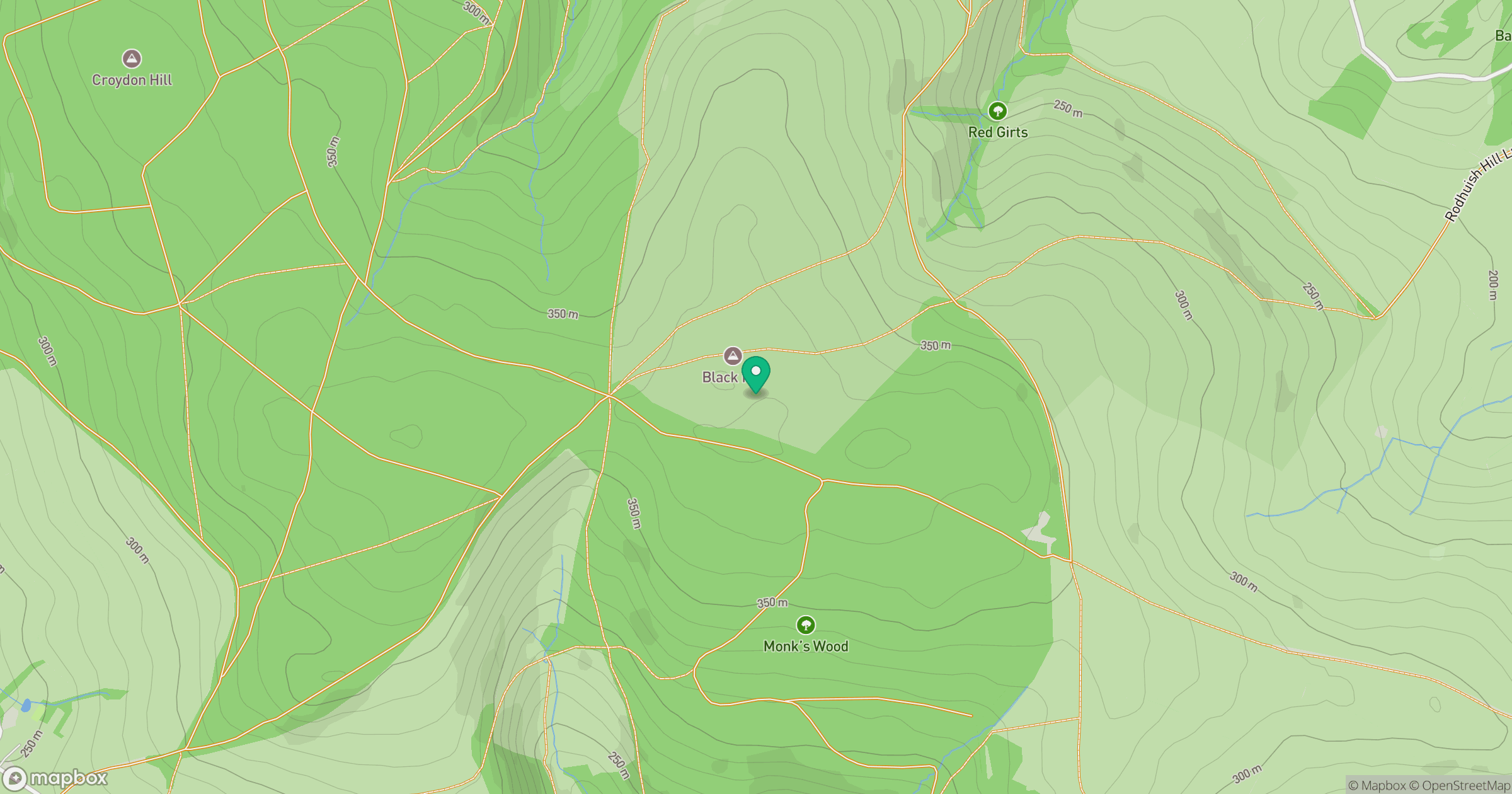
Grid reference: SS987393
View on OpenStreetMapOpens a map in a new tab, centred on the hill.
Hills within 30 km
Straight-line distance, not a walking route or confirmation of access.
No comments yet. Be the first.